Developers Summit 2018, Day 1
I only saw one other GIS person on my flight out. My flight was short and happier the further I got away from the snow.
The biggest news by far, is that Map Girl has been upgraded to Map Woman.
 |
| They must have had a lot of complaints. |
When I walked into the Plenary Session, I wasn't quite sure where to sit to see the screen...

They said this is the largest conference by far with over 2100 attendees. The theme is "By developers, for developers."

Monday they had a "spatial hackathon," and although I don't know what that means, I'm pretty sure my boss would win it.
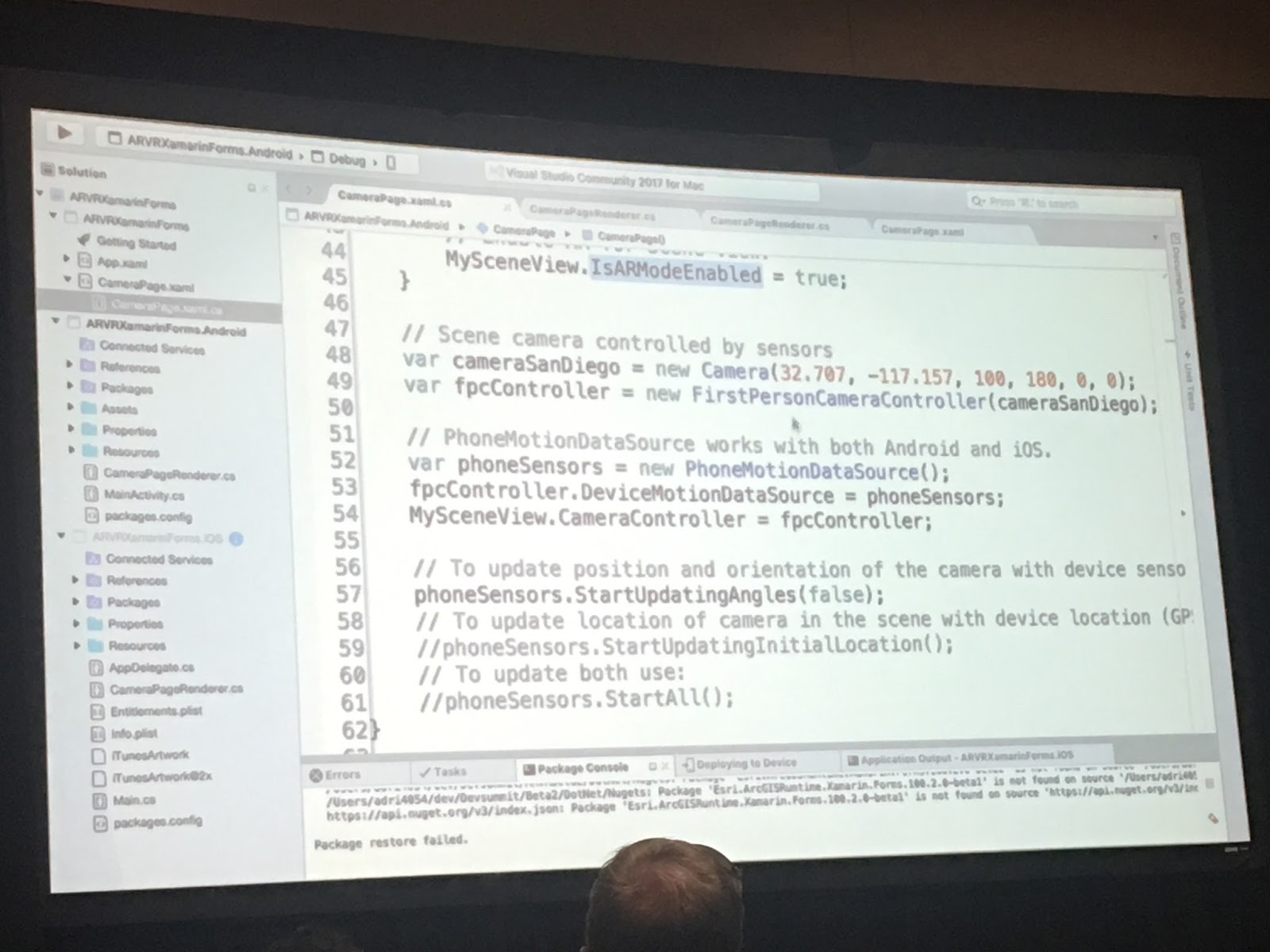
A little bit of time was spent talking about AR/VR, and a colleague from the state later said it reminded him of our demo at UVU for GIS day and that we "are on the leading edge of it." High fives all around. The only thing ESRI did that we haven't yet, is they added a viewshed in their cityscape AR app.

Apparently it pays to get there early, because the front section was recliners and couches.

They showed coding for how to change the edges of buildings to look like a sketch. It was super sweet.

They demo'd creating custom start pages in Pro, for example no ribbons or toolbars, only a custom tab with applicable tools for intended audience. Neat-o. You can also encript toolboxes that you are sharing with others.
ESRI staff like to pump themselves up with "Eye of the Tiger."
Here's one of my favorite things about GIS conferences - the men's bathroom line is long and there's never a wait for the woman's. Win.

I got a sunburn at lunch. It was 74 lovely degrees.
 |
| The lunch patio. |
 |
| LUNCH |
I ran into a bunch of Utahns in the lunch line. We ate lunch together.
After lunch I went to ArcGIS API for Python: Intro to Scripting Your Web GIS. They gave examples in Jupyter Notebooks of how to clone portals, reassign AGO content, etc. They talked about anaconda, which can be used to set up isolated environments on your computer.

Next was Getting Started with Web Development and the ArcGIS API for JavaScript.They pointed out that code is case sensitive, how to find the map center, module order makes a difference, the basic steps remain the same, renderers, and a super quick few seconds on popups and widgets.

I went to a little bit of Tracking User Engagement For Feedback...but it was a total plug for Google Analytics.
ESRI had a AR/VR demo that overlapped, I was happy to leave. They showed the same thing as the plenary and didn't go into too much detail about it. They did say that the indoors is limited by technology (ie. phone sensors and wifi).

There was an AR/VR class right after, and for a third time they showed the same demo as the plenary, and didn't go into it.
They talked about AR vs. VR, and also Mixed Reality. They classified the HoloLens as mixed reality.

10% of people get motion sickness from VR.

Through Pokemon Go, they learned that phone GPS accuracy is
GPS ~10m outside only
Wifi ~2m
Beacon ~1m
RFID ~1m
ESRI has an AR/VR beta group with 78 participants, and 65% say they haven't made an AR/VR app. More high fives.


Wow today was long. Classes went until 6:30pm. Good thing they have tubs of diet coke everywhere.
Happy GIS-ing!
Lindsy Hales Bentley
YouTube Video: https://youtu.be/Eoir08M8LDM
Happy GIS-ing!
Lindsy Hales Bentley
YouTube Video: https://youtu.be/Eoir08M8LDM
