ESRI Geodesign Summit 2022
So grateful this event was held this year virtually. I feel that this allows greater participation and opportunities to learn from a wider audience.
However, it also allows for interruptions at work, preventing me from watching the entire time. This is where in-person attendance is advantageous.
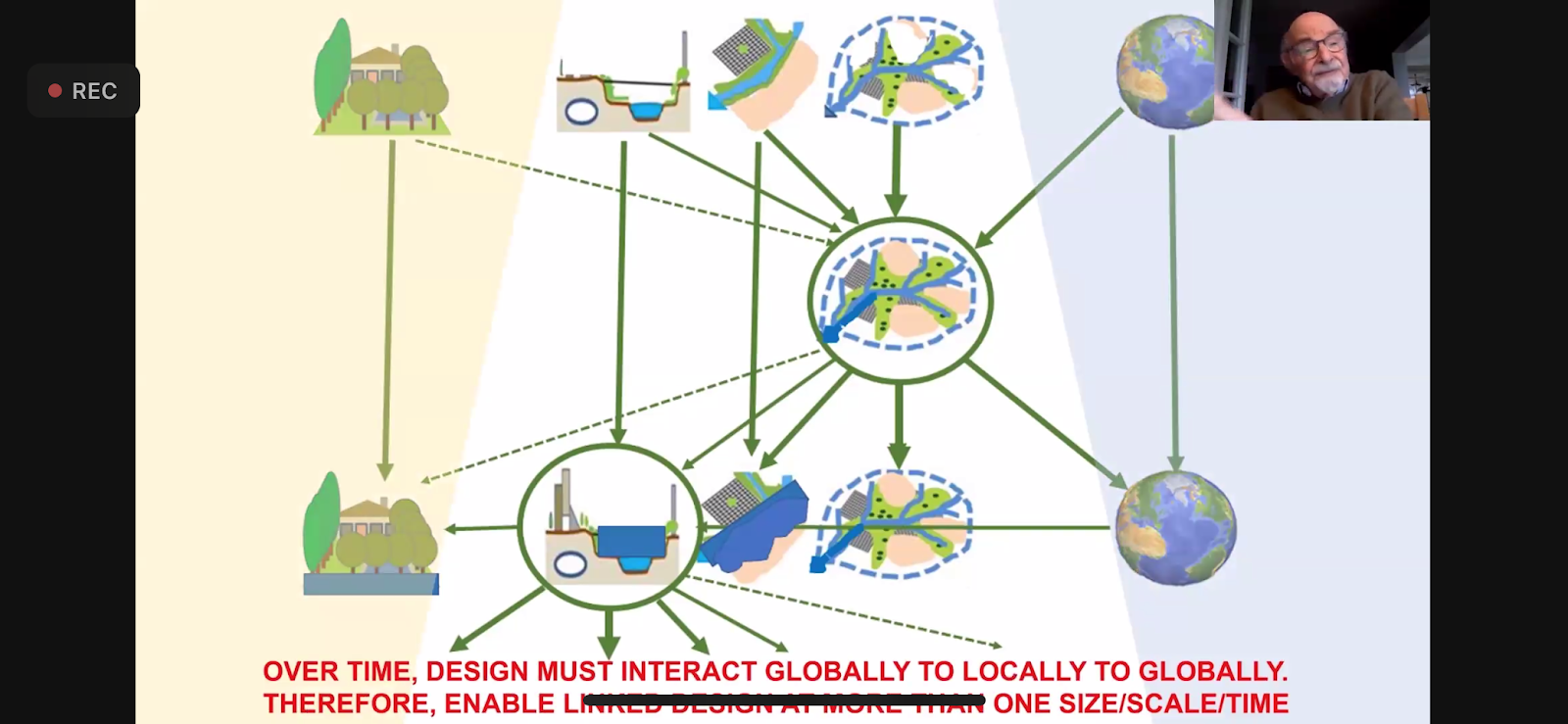
I really enjoyed one speaker that pointed out that GIS doesn't work when siloed. It is best when there is integration across departments and platforms. I have found this to be so very true, and so I constantly encourage interdepartmental and interagency collaboration.
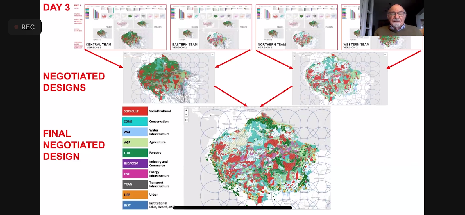
He also presented on a project that he did on the Amazon, for over 2 years, and with over 200 scientists. They came up with 89 recommendations. He spoke of how the reduction in water is affecting and diminishing the Amazon. He is a part of a International Geodesign Collaboration group with participation from 61 countries, and over 100 universities, and more that 500 people. They use Hub to organize and host their data.


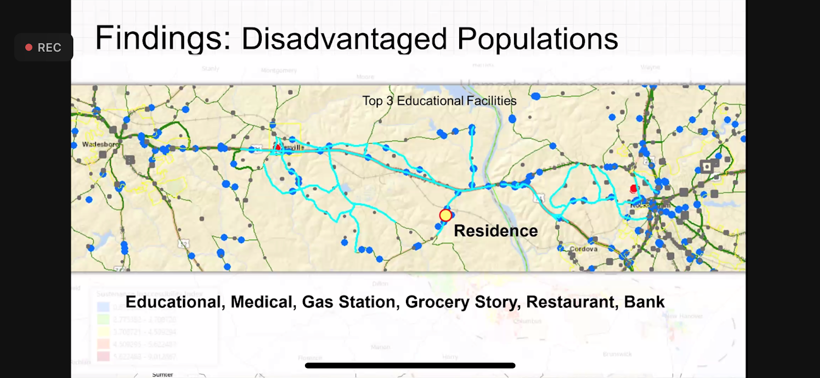
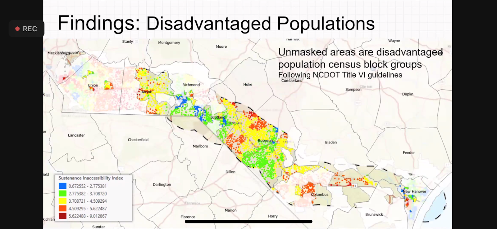
Another speaker presented on a Resiliency Study for a transportation corridor in North Carolina.

He described it as a "hurricane magnet."


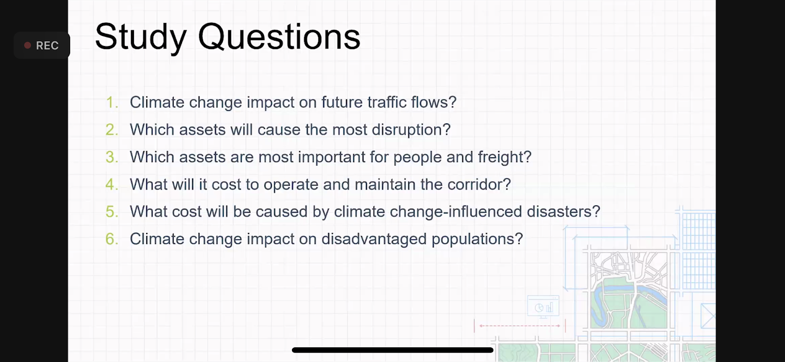
He talked through using City Simulator, an extension in ArcMap, to answer a host of questions about storm impacts.

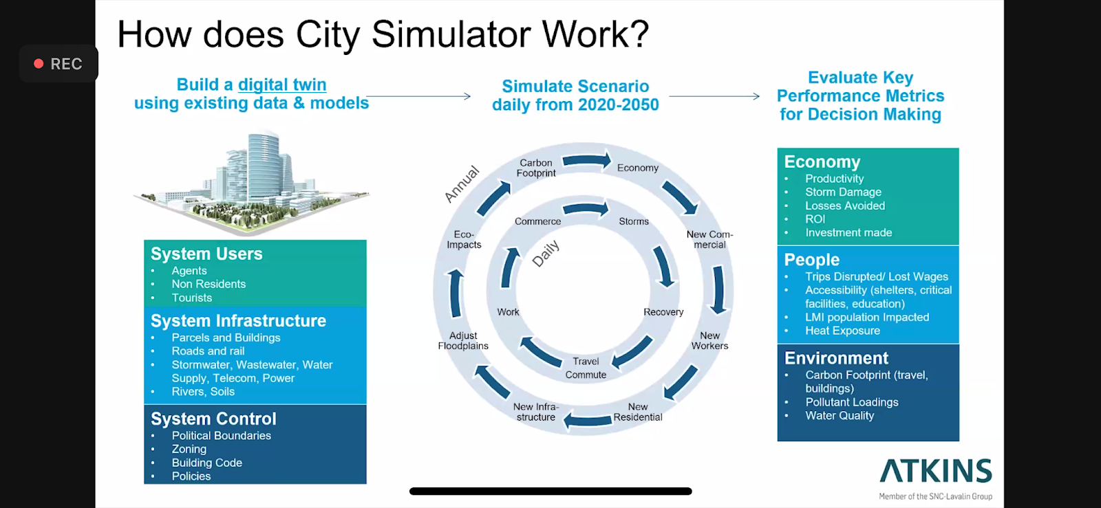
He showed a video, demoing a rainstorm that flood overtops bridges, riverbanks, and pipelines and disrupts traffic, estimating duration, and taking into account various climate stressors like rainfall, temperatures, and sea level.